www.lfweathercenter.com      Twitter Facebook NWS Grand Rapids, Michigan Weather Underground    

Aurelius Township - Ingham County - Michigan - U.S.A.
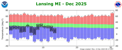
- Local Weather Stations -
Columbia Lakes
W Columbia Rd near Onondaga Rd    Bond Park Area    N College Rd near Hogsback Rd
Mason Jewet Field Airport 72 Hour Observation History
Lansing Year To Date Climate Plot    Lansing Current Month Climate Plot

  
National Weather Service Forecast
Aurelius Township, Michigan, U.S.A.
Forecast issued at 1:07 pm EDT Mar 31, 2025 by the National Weather Service Grand Rapids, MI
4    D A Y    F O R E C A S T    A T    A    G L A N C E
 
This
Afternoon
This Afternoon: Mostly cloudy, with a high near 42. Northwest wind around 15 mph.
Mostly Cloudy
Tonight

Tonight: Mostly cloudy, then gradually becoming clear, with a low around 25. North northwest wind 8 to 11 mph, with gusts as high as 20 mph.
Decreasing
Clouds
Tuesday

Tuesday: Increasing clouds, with a high near 44. North northeast wind 6 to 8 mph becoming east in the afternoon.
Increasing
Clouds
Tuesday
Night
Tuesday Night: A slight chance of rain showers before 9pm, then a slight chance of snow showers between 9pm and 2am, then a chance of rain and snow showers after 2am.  Mostly cloudy, with a low around 32. East southeast wind 10 to 15 mph, with gusts as high as 29 mph.  Chance of precipitation is 40%.
Chance
Rain/Snow
Wednesday

Wednesday: Showers and possibly a thunderstorm before 2pm, then showers between 2pm and 5pm, then showers and possibly a thunderstorm after 5pm.  High near 64. Breezy, with an east southeast wind 16 to 20 mph, with gusts as high as 34 mph.  Chance of precipitation is 100%.
Showers and
Breezy
Wednesday
Night
Wednesday Night: Showers and possibly a thunderstorm before 11pm, then showers between 11pm and 2am.  Low around 49. Chance of precipitation is 80%.
Showers
Thursday

Thursday: Mostly sunny, with a high near 62.
Mostly Sunny
Thursday
Night
Thursday Night: Mostly cloudy, with a low around 37.
Mostly Cloudy
Friday

Friday: Mostly sunny, with a high near 55.
Mostly Sunny
 
Hi 42 °F Lo 25 °F Hi 44 °F Lo 32 °F Hi 64 °F Lo 49 °F Hi 62 °F Lo 37 °F Hi 55 °F
48 Hour Temperature and Dew Point Forecast
DEW POINT: 60-64=Slightly Humid, 65-69=Humid, 70-74=Very Humid, 75-79=Oppressively Humid, Greater than 79=Very Oppressively Humid
48 hour temperature forecast
48 Hour Precipitation Potential and Sky Cover Forecast
48 hour temperature forecast
48 Hour Rain and Thunder Forecast
48 hour precipitation forecast
48 Hour Snow Freezing Rain and Sleet Forecast
48 hour forecast
48 Hour Wind Forecast
48 hour precipitation forecast
 
>>> 7 Day Forecast with Hourly Graphs <<<
This Afternoon through Sunday
 
  This
Afternoon
This Afternoon: Mostly cloudy, with a high near 42. Northwest wind around 15 mph.
Mostly Cloudy
  Hi 42 °F
 
Mostly cloudy, with a high near 42. Northwest wind around 15 mph.
 
 
  Tonight

Tonight: Mostly cloudy, then gradually becoming clear, with a low around 25. North northwest wind 8 to 11 mph, with gusts as high as 20 mph.
Decreasing
Clouds
  Lo 25 °F
 
Mostly cloudy, then gradually becoming clear, with a low around 25. North northwest wind 8 to 11 mph, with gusts as high as 20 mph.
  Tuesday

Tuesday: Increasing clouds, with a high near 44. North northeast wind 6 to 8 mph becoming east in the afternoon.
Increasing
Clouds
  Hi 44 °F
 
Increasing clouds, with a high near 44. North northeast wind 6 to 8 mph becoming east in the afternoon.
 
 
  Tuesday
Night
Tuesday Night: A slight chance of rain showers before 9pm, then a slight chance of snow showers between 9pm and 2am, then a chance of rain and snow showers after 2am.  Mostly cloudy, with a low around 32. East southeast wind 10 to 15 mph, with gusts as high as 29 mph.  Chance of precipitation is 40%.
Chance
Rain/Snow
  Lo 32 °F
 
A slight chance of rain showers before 9pm, then a slight chance of snow showers between 9pm and 2am, then a chance of rain and snow showers after 2am. Mostly cloudy, with a low around 32. East southeast wind 10 to 15 mph, with gusts as high as 29 mph. Chance of precipitation is 40%.
  Wednesday

Wednesday: Showers and possibly a thunderstorm before 2pm, then showers between 2pm and 5pm, then showers and possibly a thunderstorm after 5pm.  High near 64. Breezy, with an east southeast wind 16 to 20 mph, with gusts as high as 34 mph.  Chance of precipitation is 100%.
Showers and
Breezy
  Hi 64 °F
 
Showers and possibly a thunderstorm before 2pm, then showers between 2pm and 5pm, then showers and possibly a thunderstorm after 5pm. High near 64. Breezy, with an east southeast wind 16 to 20 mph, with gusts as high as 34 mph. Chance of precipitation is 100%.
 
 
  Wednesday
Night
Wednesday Night: Showers and possibly a thunderstorm before 11pm, then showers between 11pm and 2am.  Low around 49. Chance of precipitation is 80%.
Showers
  Lo 49 °F
 
Showers and possibly a thunderstorm before 11pm, then showers between 11pm and 2am. Low around 49. Chance of precipitation is 80%.
  Thursday

Thursday: Mostly sunny, with a high near 62.
Mostly Sunny
  Hi 62 °F
 
Mostly sunny, with a high near 62.
 
 
  Thursday
Night
Thursday Night: Mostly cloudy, with a low around 37.
Mostly Cloudy
  Lo 37 °F
 
Mostly cloudy, with a low around 37.
  Friday

Friday: Mostly sunny, with a high near 55.
Mostly Sunny
  Hi 55 °F
 
Mostly sunny, with a high near 55.
 
 
  Friday Night   A chance of showers after 2am. Mostly cloudy, with a low around 36.   Saturday   A chance of showers. Mostly cloudy, with a high near 52.  
 
  Saturday Night   A chance of showers. Mostly cloudy, with a low around 35.   Sunday   A chance of showers. Partly sunny, with a high near 51.  


NATIONAL WEATHER SERVICE
Winter Storm Severity Index
Probabilistic Snowfall Experiment
Forecast Page
Printable Forecast
Hourly Forecast Graph
>>> 7 Day Forecast with Hourly Graphs <<<
ADDITIONAL FORECAST SOURCES
CBS 6 - WLNS - Lansing, MI
NBC 10 - WILX - Lansing, MI
FOX 47 - WSYM - Lansing, MI

AccuWeather
The Weather Channel
S E V E R E    W E A T H E R    I N F O R M A T I O N
- Grand Rapids, Michigan Radar -
- Current Weather Statements -
- Severe Weather Outlook -
Click to visit National Weather Service Click to visit National Weather Service Click for Severe Weather Outlook
 
Midwest Satellite
Click for More Features
 
Day 1 Precipitation Quantity Forecast
Day 1 Precipitation Forecast - Day 1
Day 1 Excessive Rainfall Forecast
Day 1 Excessive Rainfall Forecast - Day 1
Day 1 Probability of at least 4 inches of Snow
Day 1 4 inch Snow Probabilities - Day 1
 
Advisories to the south
Advisories South
National Weather Service
Grand Rapids, Michigan, U.S.A.
-    A R E A    F O R E C A S T    D I S C U S S I O N    -
Forecast Discussion for GRR NWS Office
637 FXUS63 KGRR 311658 AFDGRR  Area Forecast Discussion National Weather
Service Grand Rapids MI 1258 PM EDT Mon Mar 31 2025  .KEY MESSAGES...  -
Wintry Mix Likely Tuesday Night  - Severe Weather Possible Wednesday  -
Chance of Rain Showers This Weekend 

NWS GRR Office Area Forecast Discussion

Never base important decisions on this or any weather information obtained from the Internet
Weather Advisory & NWS Forecast PHP Scripts courtesy of saratoga-weather.org